Long ago, there was a beautiful patch of land that was nice enough so much so it was designated to cater for government officials’ homes and properties. Sadly, not long after the buildings were erected, the structures on the ground began to deteriorate. What’s more, people far and near started to use that piece of land as an unofficial landfill. Thankfully, this spot was saved by the government together with the Forest Research Institute of Malaysia. And that’s how the Taman Tugu Hike Trails are preserved!
At this time, more than 1,000 trees in this location have explicitly been marked for preservation. More than this, every year, different species of trees, indigenous species included, are planted to further preserve and grow this beautiful forest.
We’re super lucky that this site didn’t go the way that most of its kind typically do – becoming a mall or another structure meant for commercial purposes.
So, if you’re looking for a nice place to spend your next day off, pick up a Taman Tugu trail map or access the trail map online here and have a blast!
Disclaimer: This post contains affiliate links. If you buy using the link, you help put food on my table at no extra costs to you. I appreciate you.
| Summary of Taman Tugu Hike Trails |
|---|
| Height: 488 ft Distance: 5 km in total Elevation gain: 341 ft Difficulty: Beginner Route type: Loop Average time: 20 mins to 2 hours (Round trip, longer if you hike with kids or explore) Permit required: No Parking: Free. But exit by 6.30pm. A fine of RM50 will be imposed for any exits after 6.30pm Entrance fee: No Kid-friendly: Yes Nearby attractions: Yes Retreats and getaways: Yes Google Maps guide to Taman Tugu Hike Trails attractions and activities here. |
- How to Reach Taman Tugu Park
- If You're Driving To Taman Tugu Kuala Lumpur
- Exploring The Five Trails That Taman Tugu Has To Offer
- Terrains Of The Taman Tugu Hike Trails
- Fun Things To Do After Covering The Taman Tugu Trails Map
- Best Attractions Near Taman Tugu Hike Trails
- Great Staycations Nearby Taman Tugu
- Popular Questions About The Taman Tugu Hike Trail
How to Reach Taman Tugu Park
While it might get less attention than activities like hiking in Perak Maxwell Hill hiking or taking on the Bukit Larut height, the fact is, trekking the distance of the Taman Tugu hike trails has its merits. And they are pretty considerable, too.
Not to be mistaken for the Taman Tugu hike trails near Texas or, for that matter, the Taman Tugu hike trails near California, reaching the entrance of this hiking spot is relatively simple.
To follow the easy way, just use Grab and give your location.
However, if you plan to make your way over to this spot via public transport, be prepared for it to take a little more effort getting to the entrance of the Taman Tugu hiking trail.
The biggest reason for this is that the nearest train stations to this hiking trail are the KTM Bank Negara and LRT Masjid Jamek, and you have to walk for at least 30 to 40 minutes from the highway before you can access either of these.
You could make life easier by stopping at the MRT Semantan Gate B and then getting on the T820 bus. The T820 bus will drop you at the Taman Tugu bus stop. From there, you’ll only need to walk for about 15 to 20 minutes before you get to the entrance.
One good thing about this second approach is that you can just get to the Taman Tugu hike trails this way! This is because, following this route, you can see incredible scenes like the War National Monument, the ASEAN Sculpture Garden, and even the Taman Tugu Café and Catering hub.

Source: Yusnira Yusoff | AllTrails
If You’re Driving To Taman Tugu Kuala Lumpur
Bringing a private car to Taman Tugu Kuala Lumpur does add a certain degree of comfort and convenience to your trip. This is because of the degree of control it affords you over your transportation, something you can only have a little of.
All you have to do to find your way to this spot is input “Taman Tugu Hike Trails” into the search bar on Waze or Google Maps, and you’ll have clear directions to follow. These trails are the green space directly visible above the Perdana Botanical Garden.
As mentioned, you’ll get toll-free parking at the Taman Tugu Nursery parking lot. And it’s quite spacious too, so you won’t have to worry about finding a spot no matter when you get there. Parking is only free here from 7:00 AM to 6:30 PM. Staying any longer could result in an RM 50 fine.
However, if you come around on a day that the Nursery parking lot is full, you should still be able to find convenient parking space on the eastern end of the site. You could park at Padang Merbok or Lake Gardens. These are only 5 and 15 minutes away from the entrance by foot, respectively. You should also know that the parking may be a cost here.

The Complete Taman Tugu Trail Map Guide: Taman Tugu Official Site
Exploring The Five Trails That Taman Tugu Has To Offer
Just ask anyone who has ever been to this location, and they’ll tell you that picking the best Taman Tugu hike trails is next to impossible! A quick look at the Taman Tugu hike trails map and terrain will tell you that even beginner hikers and kids will be fine covering the entire expanse.
Moreover, compared to hiking in Perak along the Bukit Larut hiking trail, you have considerably more options to explore here in the city after hike (see my suggestions below). The recent addition of the Orange Trail makes it a total of five different trails that Taman Tugu offers, as opposed to the two you get when covering the Bukit Larut height.
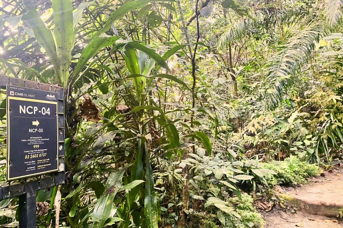
CIMB Islamic adopts these trails, so the pathways are all well-maintained, with well-lit signage to guide hikers along the way.
Here’s a concise breakdown of the trails available here:
- The Green Trail – 1.5 km
- The Yellow Trail – 1.5 km
- The White Trail – 1.0 km
- The Nursery Trail – 1.0 km
- The Orange Trail – 1.1 km
| Access the Taman Tugu Trail Interactive Map here. This handy map shows you the five trails as outlined by their respective colors. You need an Internet connection for this site, so it is best to screenshot the map and save it offline on your phone, although the connection around the trails is generally OK. It’s not a secluded trail. |
Terrains Of The Taman Tugu Hike Trails
Outdoor enthusiasts will be able to navigate the various Taman Tugu hike trail directions easily. Of course, it helps that you don’t have to look too far to come across an accurate map during your hike. You’ll see several of these posted along the various routes.
Having said that, one thing you must pay close attention to here is the terrain. How good or bad this is is influenced strongly by whether or not it rains.
For example, this factor is critical if you’re taking on the Orange Trail. Because this trail has a fairly steep uphill climb toward the end, you should tackle it when the floor is dry and offers better traction.
Also, along the best Taman Tugu hike trails, you’re likely to encounter many monkeys and insects. The former will most likely scamper away once they see you. The latter will not shift ground, so you may want to come along with a pretty strong insect repellent.

Source: Faradhila Armen | AllTrails
Fun Things To Do After Covering The Taman Tugu Trails Map
The beauty of this particular location continues to shine, even beyond the experience with nature that it offers. For example, after overcoming the Taman Tugu hike trail difficulty, you might feel a little dirty, naturally. There are washrooms and restrooms on-site, so you can clean up if you want!
Also, visitors can enjoy a touch of class after exploring the Taman Tugu trail distance.
There’s a simple yet tastefully designed resting area at the forest entrance where you can sit back and enjoy yourself. With plenty of green to relax your mind, overhead fans to keep you cool, and many beautiful birds to keep you company, you can have a completely different type of adventure right here!
Of course, you can get even more out of this trip by attending several programs and shows hosted by the local forest management. Some of these include;
The nature education program:
- Zumba Rimba
- Taman Tugu Plant Giveaway (Uniqlo)
- Taman Tugu Plant & Hunt (Uniqlo)
For more info on other things to do, check out Taman Tugu’s Official Website.
Best Attractions Near Taman Tugu Hike Trails
Have a long weekend? I put together and bookmarked these places of attraction (linked in Google Maps):
- Tugu Negara Perdana Botanical Garden
- ASEAN Sculpture Garden
- Sri Maha Mariamman Alayam
- Taman Tugu fountain
- Taman Tugu Café & Catering
- Kuala Lumpur Butterfly Garden
- Bank Negara Malaysia Museum and Art Gallery
- Kuala Lumpur City Center for shopping and its park.
Great Staycations Nearby Taman Tugu
For after hike pampering sessions, head over to these shortlisted hotels and luxury stays near Kuala Lumpur City Center:
- Tamu Hotel & Suites
- Mandarin Oriental Hotel
- Four Seasons Hotel
- InterContinental Kuala Lumpur
- The Westin
- The RuMa Hotel & Residences

Popular Questions About The Taman Tugu Hike Trail
How Long Is The Taman Tugu Hike Trail?
The Taman Tugu hike trail is roughly 5 km long. The entire Taman Tugu trail distance is divided into 5 routes. Each of which spans between 1 to 1.5 km long.
How Much Is The Entrance To Bukit Tugu?
The entrance to Bukit Tugu is completely toll-free. In addition to this, the best Taman Tugu hike trails are open all year round to hikers. Also, parking in this location is accessible from 7:00 AM to 6:30 PM.
How To Get To Taman Tugu?
You can use a train from KTM Bank Negara or LRT Masjid Jamek station. Also, you could get the T820 bus, which will drop you at the Taman Tugu bus stop. Of course, you also have the option of simply taking a Grab.